


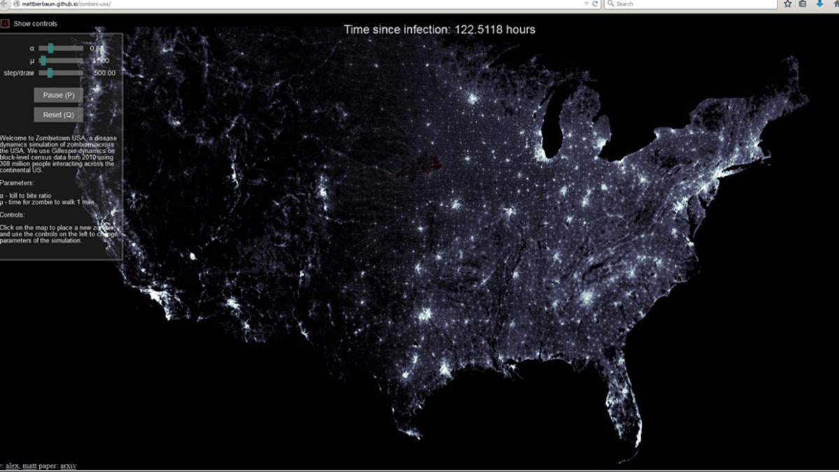
Screenshot from http://mattbierbaum.github.io/zombies-usa/.
Want to know where to run away to next time there is a zombie apocalypse? Well, now there is a zombie infection-mapping tool called Zombietown USA that gives users a way to pinpoint where the infection is spreading. The infection in question is hypothetical, of course, but the scenario that the mapping tool suggests is more grounded in science than stolen from a “Walking Dead” episode.
Zombietown USA developed out of research out of Cornell University from graduate students Alex Alemi and Matt Bierbaum, reports CNET. The research team recently determined how a potential zombie outbreak could spread across the United States — one big takeaway is that you should stay out of large urban areas if you want to avoid brain-eating zombies.
They researchers were initially inspired by Max Brooks’s popular novel “World War Z,” and said that, even though the scenario they were modelling was fanciful, their work could have real world implications for figuring out how people could respond to real-world pandemics.
Alemi, Bierbaum, Christopher Myers, and James Sethna recently submitted “You Can Run, You Can Hide: The Epidemiology and Statistical Mechanics of Zombies” to online physics research ub, arXiv. Coupled with the paper, Zombietown USA applies hard science to a scenario that fits in more with science fiction.
“We wanted to study zombies using many of the scientific tools used for actual disease, albeit in a fun context,” Bierbaum told CNET. “We hope in this way to introduce the real methods and science behind diseases to a broader audience and show the fun in science.”

Get a daily look at what’s developing in science and technology throughout the world.