National forecast for Monday, August 24
Fox News senior meteorologist Janice Dean has your FoxCast.
NASA satellite images show Tropical Storms Marco and Laura swirling in the Gulf of Mexico and drenching Hispaniola, respectively.
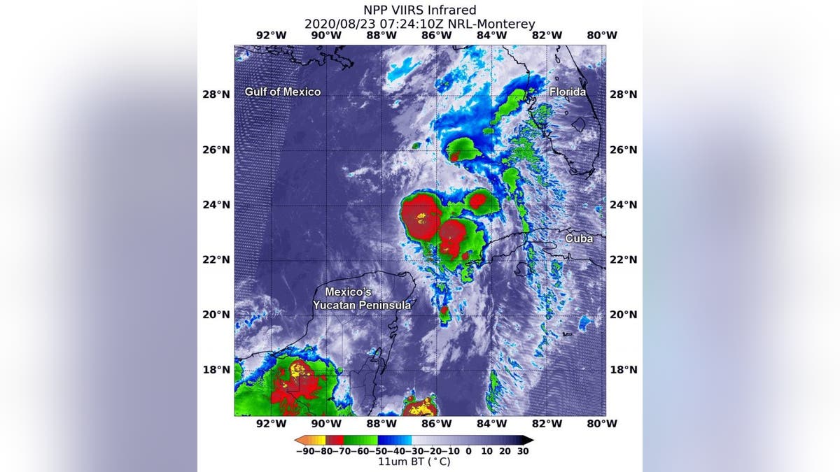
The Suomi NPP satellite, which is operated by NASA and the National Oceanic and Atmospheric Administration (NOAA), passed over Tropical Storm Marco in the Southern Gulf of Mexico on Sunday. The satellite used its VIIRS (Visible Infrared Imaging Radiometer Suite) instrument to capture an image of the storm at 3:24 a.m. EDT.
TROPICAL STORM MARCO, NO LONGER HURRICANE, SET TO MAKE LANDFALL IN LOUISIANA

The VIIRS instrument aboard NASA-NOAA’s Suomi NPP satellite captured this image of Tropical Storm Marco in the Southern Gulf of Mexico on Aug. 23 at 3:24 a.m. EDT (0724 UTC). There were several areas (yellow) within where cloud top temperatures were as cold as minus 80 degrees Fahrenheit, indicating powerful storms. (Credit: NASA/NRL)
Marco strengthened to a hurricane Sunday but has since weakened to a tropical storm. The storm is expected to make landfall in Louisiana around midday Monday.
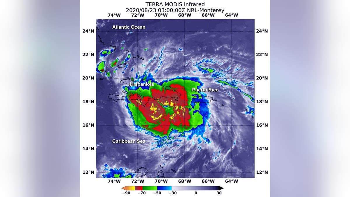
The imagery of Tropical Storm Laura was also captured by NASA’s Terra satellite at 11 p.m. EDT on Saturday.
“Very powerful storms with heavy rainmaking capability reach high into the atmosphere and those have very cold cloud top temperatures,” explained NASA on its website. “Infrared imagery from NASA’s Terra satellite measures those temperatures and found those kind of powerful storms in Tropical Storm Laura drenching Hispaniola.”
ONCE HURRICANES, PAIR OF TROPICAL STORMS CLOSE IN ON LOUISIANA

On Aug. 22 at 11 p.m. EDT the MODIS (Moderate Resolution Imaging Spectroradiometer) instrument on the Terra satellite revealed the most powerful thunderstorms (yellow) surrounded Laura’s center where cloud top temperatures were as cold as or colder than minus 80 degrees Fahrenheit, according to NASA. Strong storms with cloud top temperatures as cold as minus 70 degrees (red) Fahrenheit surrounded those areas and blanketed Hispaniola and were dropping large amounts of rain, the space agency said. (Credit: NASA/NRL)
Laura caused the deaths of at least 11 people in the Dominican Republic and Haiti, while knocking out power and causing flooding in the two nations that share the island of Hispaniola.
CLICK HERE TO GET THE FOX NEWS APP
The tropical storm was forecast to move along Cuba's southern coast Monday before entering the Gulf of Mexico and heading toward the same stretch of U.S. coast as Marco later in the week, most likely as a hurricane.
The Associated Press contributed to this article. Follow James Rogers on Twitter @jamesjrogers


