


A wildfire in Texas led to a massive pyrocumulus cloud that produced a severe thunderstorm on Friday. (NWS)
The famous saying goes that "everything is bigger in Texas," but that also appears to apply to a wildfire that was so intense on Friday it created a severe thunderstorm.
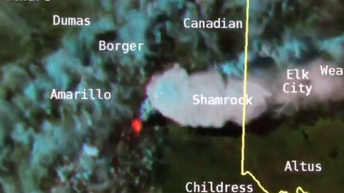
The Mallard Fire, which is burning an area southeast of Amarillo in the state's panhandle, has burned more than 73,000 acres since it started on May 8. On Friday, the blaze was so intense that a pyrocumulus cloud formed, which helped to produce a thunderstorm that reached severe limits northeast of the blaze.
The National Weather Service posted video on Twitter showing the development of the storm.
The NWS noted the "impressive visual" of pyrocumulonimbus clouds. "Notice the bright spots indicating where the hottest temperatures are occurring," it tweeted.
Pyrocumulus clouds form from "rising air that results from intense heating of the surface by phenomena such as wildfires or volcanic eruptions," according to professors at the University of Wisconsin.
If the clouds develop in an area with humidity, the pyrocumulus cloud can form into a thundercloud, also known as pyrocumulonimbus.
"Like thunderstorms, pyrocumulonimbus can produce lightning because of the strong updrafts," UW professors noted. "Rain can also fall from these clouds, which could help extinguish the fire generating the cloud."
HAWAII VOLCANO STOKES FEARS OF WEST COAST ERUPTIONS
The storm on Friday was noted to have a large amount of lightning, according to Randy Bowers, a forecaster at the National Weather Service in Norman, Okla.
"Pyrocumulonimbus in the Texas Panhandle," Bowers wrote on Twitter. "Probably very little rain reaching the ground, but the amount of lightning in ENTLN is amazing!"
Others reacted to Twitter and posted photos of the massive cloud generated by the blaze.
Fox News Artificial Intelligence
Stay up-to-date on the latest AI technology advancements and learn about the challenges and opportunities AI
By entering your email and clicking the Subscribe button, you agree to the Fox News Privacy Policy and Terms of Use, and agree to receive content and promotional communications from Fox News. You understand that you can opt-out at any time.