Fox News Flash top headlines for Dec. 10
Fox News Flash top headlines for Dec. 10 are here. Check out what's clicking on Foxnews.com
For the first time, scientists have conducted extensive mapping of the seafloor at Bikini Atoll, the remote Pacific Ocean testing site for atomic bombs between 1946 and 1954.
The research was revealed Monday at the Fall Meeting of the American Geophysical Union in San Francisco.
“The bomb testing sunk ships and created large craters on the seafloor,” explained researchers from the University of Delaware in an abstract of their research. “New discoveries include subtle bedforms visible on the seabed from the Baker bomb test, a 21 kiloton detonation, providing new insights into the forces that shaped the seabed from the blast.”
DOOMSDAY WARNING: IT WOULD ONLY TAKE 100 NUCLEAR WEAPONS TO WREAK GLOBAL DEVASTATION
The study, authored by Arthur Trembanis, Ph.D., an associate professor at the University of Delaware and doctoral student Carter DuVal, describes the site as “the world's first simulated nuclear battlefield.”

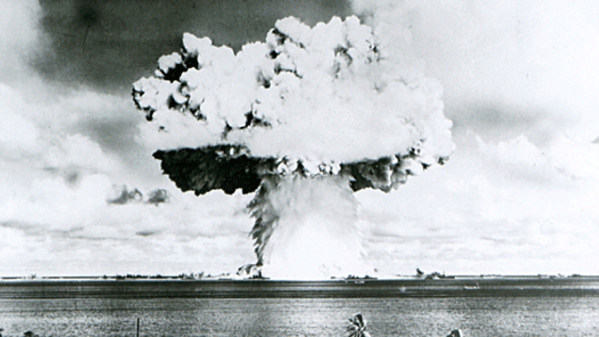
This U.S. Navy handout image shows Baker, the second of the two atomic bomb tests, in which a 63-kiloton warhead was exploded 90 feet under water as part of Operation Crossroads, conducted at Bikini Atoll in July 1946. (Reuters/U.S. Navy)
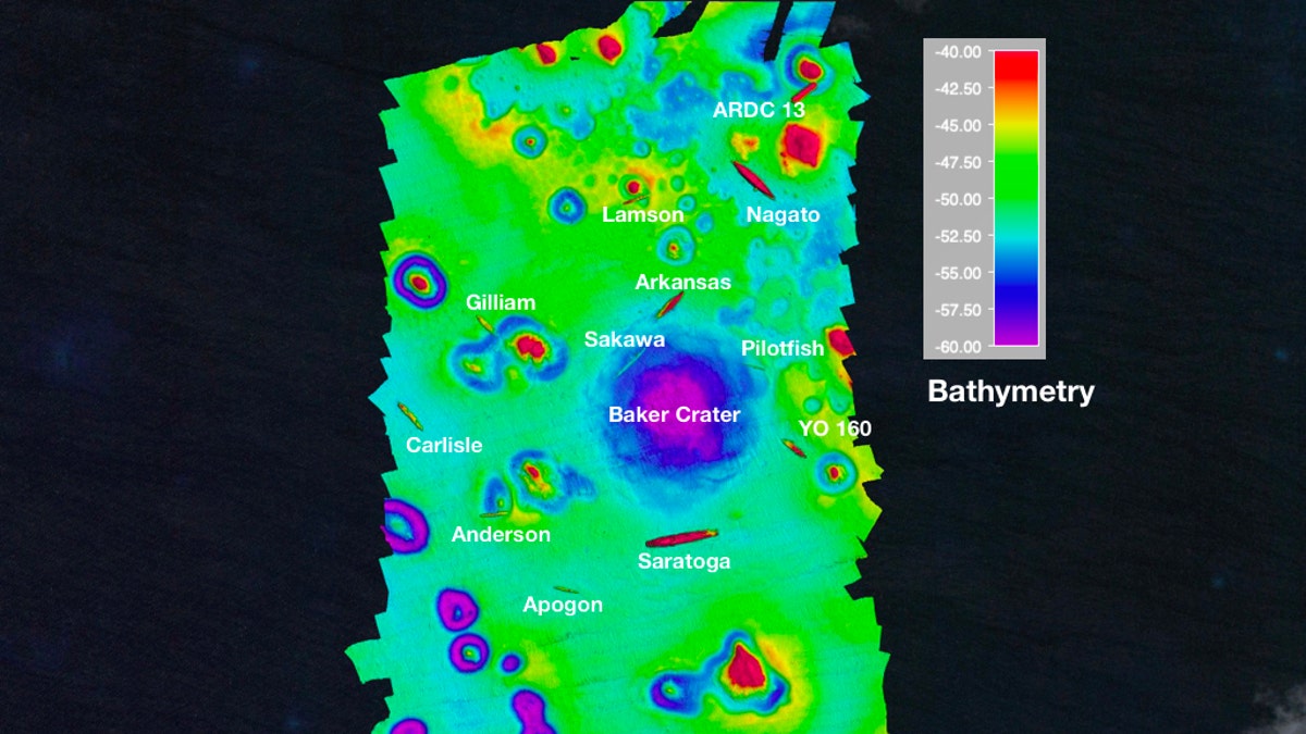
Conducted in 1946 as part of Operation Crossroads, the Baker test produced a giant mushroom cloud that was captured in iconic photographs. The test’s devastating impact on the seabed was clearly revealed in the mapping project. The Baker test crater is about 8 meters (26.2 feet) deep with a diameter of around 700 meters or 2,297 feet.
“The Baker crater is flat floored, evidence of back filling as the ejecta settled in after the explosion,” the researchers explain. “A new discovery is that there are subtle but coherent bedform features visible on the seabed that radiate away from the center of the impact crater.”
Experts, however, were unable to find any seabed evidence of the Able test, a 21-kiloton aerial explosion that was also conducted in 1946 as part of Operation Crossroads. But they did find evidence of the 1954 Castle Bravo test, a 15-megaton hydrogen fusion bomb test that obliterated three islands.
The flat-bottomed Castle Bravo crater is 25 to 30m (82 to 98.4 feet) deep and has a diameter of 1,400m (4,593 feet).

Scientists mapped the wreck of the USS Saratoga, which was sunk in the Baker test. (Arthur C. Trembanis/Carter DuVal/University of Delaware)
A dozen shipwrecks were also revealed in the mapping project. “I think for all oceanographers, it’s a site that you immediately connect with and know about,” said Trembanis, in a statement emailed to Fox News. “There are not many places you can go and try to map something in a unique way. This was definitely the case here. There are just so many shipwrecks, and each one is different.”
CLICK HERE TO GET THE FOX NEWS APP

Map of the Bikini Atoll test site with Baker crater and shipwrecks. (Arthur C. Trembanis/Carter DuVal/University of Delaware)
In separate research, scientists have revealed that radiation levels in parts of the Marshalls Islands, where the tests took place, have higher radiation levels than the 1986 Chernobyl disaster.
Fox News Chris Ciaccia contributed to this article. Follow James Rogers on Twitter @jamesjrogers

