


Isaias leaves trail of destruction through North Carolina
Leland Vittert reports from Windsor with an update on the storm damage up the East Coast.
NASA’s CloudSat satellite passed directly over Tropical Storm Isaias as it was strengthening back into a hurricane on Monday.
The satellite analyzed Isaias before it made landfall in North Carolina, revealing areas of heavy rain and ice particles in high, powerful clouds.
“CloudSat passed east of the storm center revealing the large area of deep convection (rising air that condenses and forms the thunderstorms that make up a tropical cyclone),” explained NASA’s Goddard Space Flight Center, in a statement.
TROPICAL STORM ISAIAS FLOODING SWEEPS PENNSYLVANIA WOMAN AWAY IN HER CAR
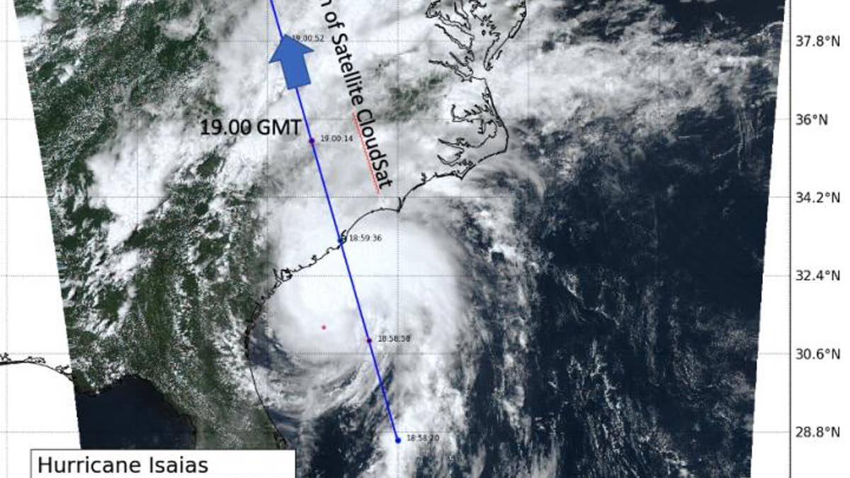
This visible image of Tropical Storm Isaias was taken from NOAA's GOES-East satellite on Aug. 3 at 3.p.m. EDT shows the path that CloudSat observed the storm. (NASA)
CloudSat uses sophisticated cloud-profiling radar to “slice” through clouds and see their vertical structure, according to the government agency.
"The anvil of the system extended northwestward across North and South Carolina with maximum cloud heights estimated at 16-17 km (10 to 11 miles)," said Natalie Tourville of the Cooperative Institute for Research in the Atmosphere, Colorado State University, Fort Collins, in the NASA statement.
CLICK HERE TO GET THE FOX NEWS APP
At least six people were killed as Tropical Storm Isaias spawned tornadoes and dumped rain Tuesday along the U.S. East Coast after making landfall as a hurricane in North Carolina, where it caused floods and fires that displaced dozens of people.
The Associated Press contributed to this article. Follow James Rogers on Twitter @jamesjrogers
Fox News Artificial Intelligence
Stay up-to-date on the latest AI technology advancements and learn about the challenges and opportunities AI
By entering your email and clicking the Subscribe button, you agree to the Fox News Privacy Policy and Terms of Use, and agree to receive content and promotional communications from Fox News. You understand that you can opt-out at any time.