


Stunning NASA images show historic Nebraska flooding
Stunning NASA images reveal the historic scope of the Nebraska flooding.
The historic flooding that inundated parts of the central U.S. this month was so devastating that the damage could be seen from space.
Stunning images released by NASA show the extent of the flooding in several Nebraska communities west of Omaha and between the Elkhorn and Platte Rivers, which completely flooded or became islands as water rose from both sides.
The intense late-winter storms forced residents in dozens of communities to evacuate.
NEBRASKA FLOODS SWAMP AIR FORCE BASE, AS DEVASTATION FROM 'BOMB CYCLONE' SEEN IN SATELLITE PHOTOS
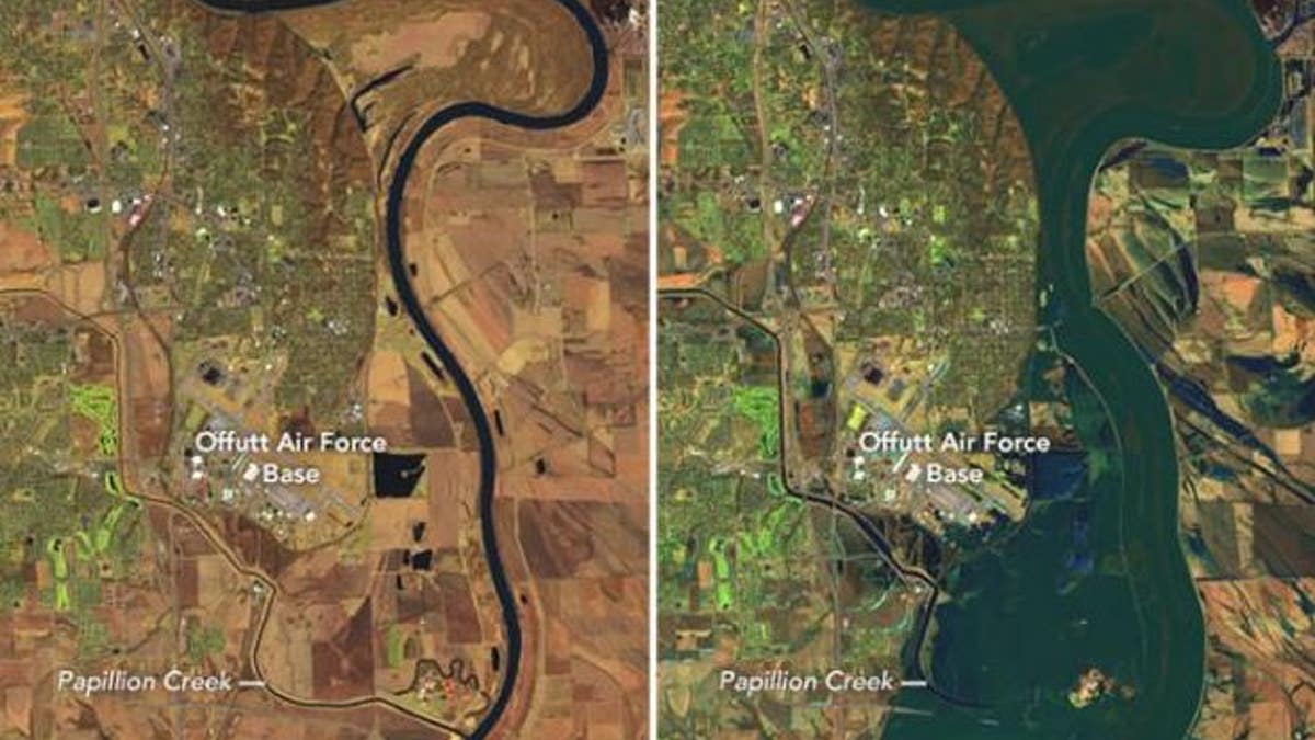
The above images, courtesy of NASA, show the extent of flooding on the Platte, Missouri, and Elkhorn Rivers, at right. The image at left shows the same area in March 2018. (NASA)
According to NASA, a unique confluence of circumstances, including extreme winter cold that created a thick layer of ice on waterways, led to the flooding.
"When an intense storm brought downpours and unusually warm air to the region in March, it rapidly melted much of the snow and ice, producing enormous runoff in a short period," the space agency explained in a statement.
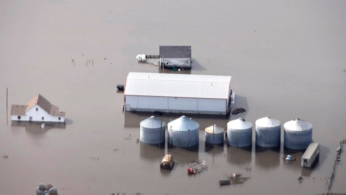
Flooding along the Missouri River in rural Iowa north of Omaha, Neb., on March 18, 2019. (Iowa Homeland Security and Emergency Management via AP)
"As river ice broke up, large chunks compounded the problem by slamming into dams, raking against levees and other infrastructure, and packing together to jam waterways even more," NASA added.
One-third of the Offut Air Force Base was underwater and 30 buildings were damaged and engulfed by up to 8 feet of water, according to the Omaha World-Herald. In addition, 3,000 feet of the base's 11,700-foot runway was submerged.
Fox News Artificial Intelligence
Stay up-to-date on the latest AI technology advancements and learn about the challenges and opportunities AI
By entering your email and clicking the Subscribe button, you agree to the Fox News Privacy Policy and Terms of Use, and agree to receive content and promotional communications from Fox News. You understand that you can opt-out at any time.