California sees its worst fire season on record, spreading to Washington, Oregon
In Southern California the Santa Ana winds are kicking up causing more problems for crews trying to contain the flames; Jeff Paul reports on the latest.
The wildfires ravaging California and Oregon have been spotted from space in remarkable satellite pictures.
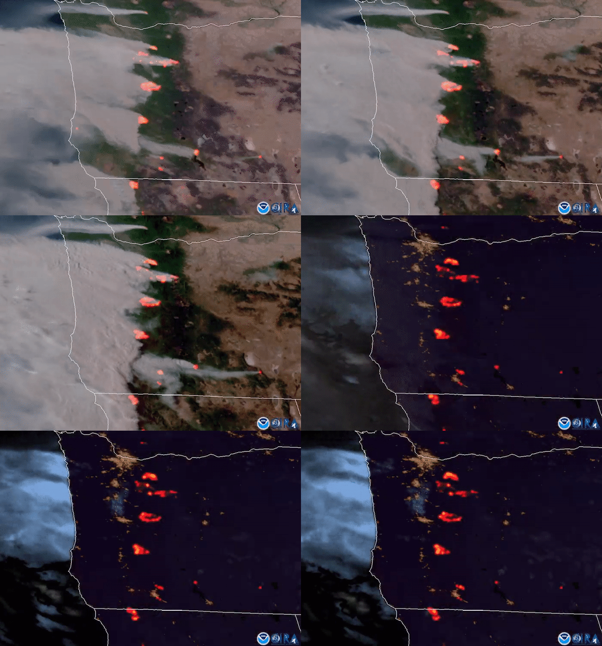
The National Oceanic and Atmospheric Administration (NOAA) tweeted satellite images of wildfires burning in Oregon. The images were captured by NOAA’s GOES-17 satellite.
“It's not just California that is battling #wildfires, Oregon is ablaze too—seen here yesterday evening from @NOAA's #GOES17,” tweeted NOAA satellites public affairs early Wednesday.
LIVE UPDATES: WILDFIRES RAGE IN CALIFORNIA, OREGON

NOAA released this GIF of the Oregon wildfires. (NOAA/CIRA)
Another satellite image provided by NOAA on Sept. 8 showed smoke from wildfires blown westward, from California's Sierra Nevada to the Coast Ranges, and from Oregon.

This satellite image provided by the National Oceanic and Atmospheric Administration at 20:36 UTC (1:36 pm PDT) shows smoke from wildfires blown westward, from California's Sierra Nevada to the Coast Ranges, at center to left, and from Oregon at top left, Tuesday, Sept. 8, 2020. (NOAA via AP)
Millions of acres of wildland and many homes and other structures have been lost to the flames.
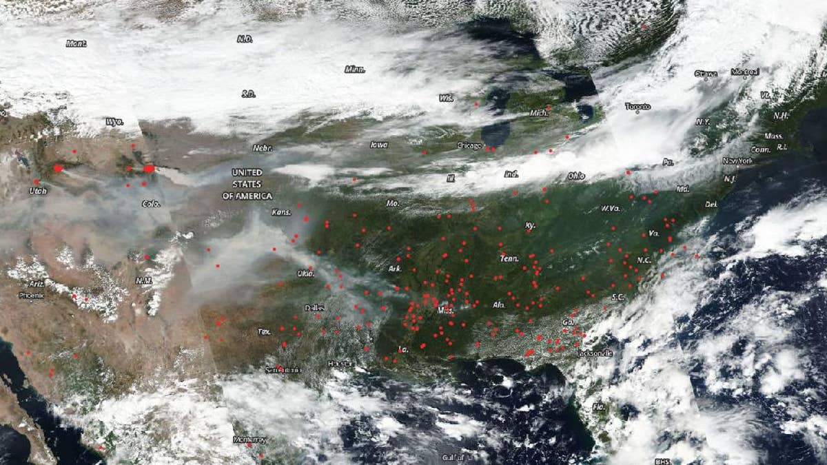
The Suomi NPP satellite, which is operated by NASA and NOAA, also captured images of the incredible scale of the wildfires.

The Suomi NPP satellite, which is operated by NOAA and NASA, captured an image of fires across America on Sep. 07, 2020. (Credits: NOAA/NASA)
The satellite captured a stunning true-color image of the wildfires across the U.S. “Obscuring the surface is a blanket of smoke from California to Arkansas with a haze present over the East Coast as well,” said NASA, in a statement.

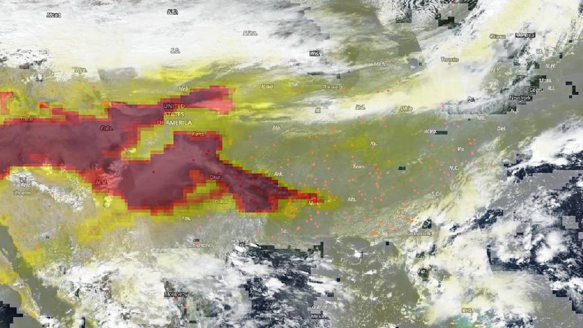
The OMPS (Ozone Mapper and Profiler Suite) on NASA and NOAA's Suomi NPP satellite was used to provide this image of the aerosols released from the burning fires which has traveled east. (Credits: NOAA/NASA)
Data on the aerosols released by the fires was also captured by the satellite. “High aerosol concentrations not only can affect climate and reduce visibility, they also can impact breathing, reproduction, the cardiovascular system, and the central nervous system, according to the U.S. Environmental Protection Agency,” NASA explained. “Since aerosols are able to remain suspended in the atmosphere and be carried in prevailing high-altitude wind streams, they can travel great distances away from their source as evidenced in these images and their effects can linger.”
CLICK HERE TO GET THE FOX NEWS APP
Wildfires rage throughout California, and gusty Diablo and Santa Ana winds could drive flames into new ferocity, authorities have warned. Dozens of wildfires are also raging across Oregon.
Fox News’ Travis Fedschun and The Associated Press contributed to this article.
Follow James Rogers on Twitter @jamesjrogers


