


Fox News Flash top headlines for Jan. 7
Fox News Flash top headlines for Jan. 7 are here. Check out what's clicking on Foxnews.com
NASA's Terra satellite captured the extent of damage from the wildfires that ravaged Australia's Kangaroo Island.
In the second image, seen below, the devastation can clearly be seen, as one-third of the island -- 155,000 hectares or 383,013 acres -- shows burn scars, as well as areas that are still on fire.
Kangaroo Island, which lies off the mainland of South Australia, contains nature reserves that are home to native wildlife and various endangered bird species.
SCIENTISTS JUST DISCOVERED GIANT 790,000-YEAR-OLD METEOR CRATER
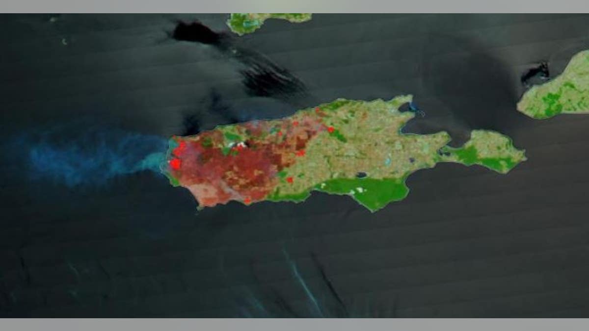
This is a Terra satellite image of Kangaroo Island on Jan. 7, 2020. (NASA Worldview)
According to NASA, burned or fire-affected areas are characterized by deposits of charcoal and ash, removal of vegetation and/or the alteration of vegetation structure.
The images were captured by NASA's Terra satellite using its MODIS instrument.
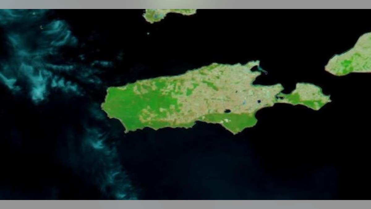
This is a Terra satellite image of Kangaroo Island taken on Dec. 16, 2019. (NASA Worldview)
NASA's Earth Observing System Data and Information System Worldview application provides the capability to interactively browse more than 700 global, full-resolution satellite imagery layers and then download the underlying data.
Fox News Artificial Intelligence
Stay up-to-date on the latest AI technology advancements and learn about the challenges and opportunities AI
By entering your email and clicking the Subscribe button, you agree to the Fox News Privacy Policy and Terms of Use, and agree to receive content and promotional communications from Fox News. You understand that you can opt-out at any time.