Move Back
ADVERTISEMENT
Skip- Published7 Images
Google Maps Galapagos Islands On Land And Sea
Users of the web giant’s Google Street View program will be able to take a panoramic tour of the island – both above and below the waterline.
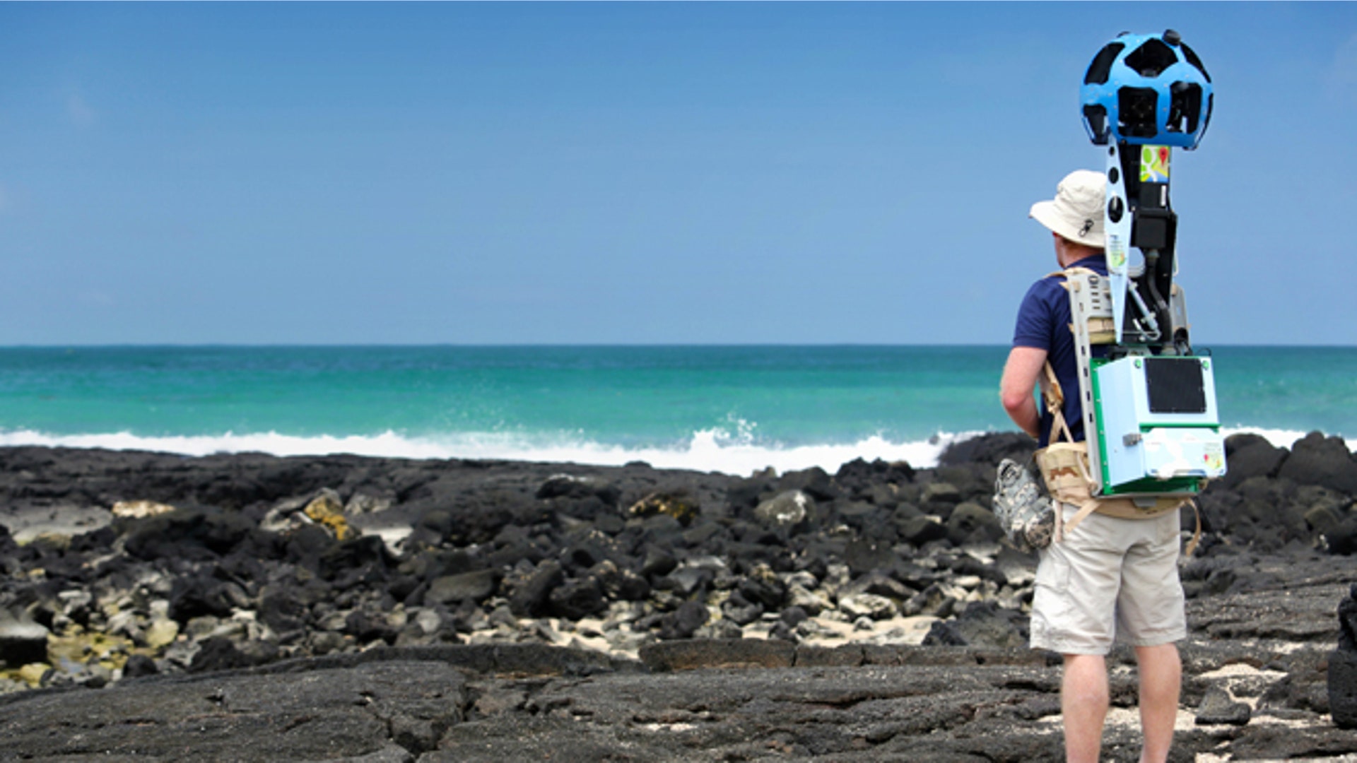
![Google_Galapagos_Stre_Grat]() In this May 2013 photo provided by Google, Daniel Orellana of the Charles Darwin Foundation collects seashore imagery with the Street View Trekker at the Los Humedales wetland area on Isabela Island in the Galapagos. Few have laid eyes on many of the volcanic islands of the Galapagos archipelago that remain closed to tourists. But soon the curious will be able to explore these places that inspired Charles Darwin's theory of evolution from their computers or mobile devices. Google Maps sent crews armed with backpack-mounted Street View cameras and underwater gear to the Galapagos, and will be bringing the islands' natural wonders to the Internet. (AP Photo/Google)read moreAP2013Share
In this May 2013 photo provided by Google, Daniel Orellana of the Charles Darwin Foundation collects seashore imagery with the Street View Trekker at the Los Humedales wetland area on Isabela Island in the Galapagos. Few have laid eyes on many of the volcanic islands of the Galapagos archipelago that remain closed to tourists. But soon the curious will be able to explore these places that inspired Charles Darwin's theory of evolution from their computers or mobile devices. Google Maps sent crews armed with backpack-mounted Street View cameras and underwater gear to the Galapagos, and will be bringing the islands' natural wonders to the Internet. (AP Photo/Google)read moreAP2013Share![Google_Galapagos_Stre_Grat__6_]() In this May 2013 photo provided by Catlin Seaview Survey, Christophe Bailhache navigates an SVII camera through a large group of sea lions during a survey dive at Champion Island in Galapagos. Few have laid eyes on many of the volcanic islands of the Galapagos archipelago that remain closed to tourists. But soon the curious will be able to explore these places that inspired Charles Darwin's theory of evolution from their computers or mobile devices. Google Maps sent crews armed with backpack-mounted Street View cameras and underwater gear to the Galapagos, and will be bringing the islands' natural wonders to the Internet. (AP Photo/Catlin Seaview Survey)read moreAP2013Share
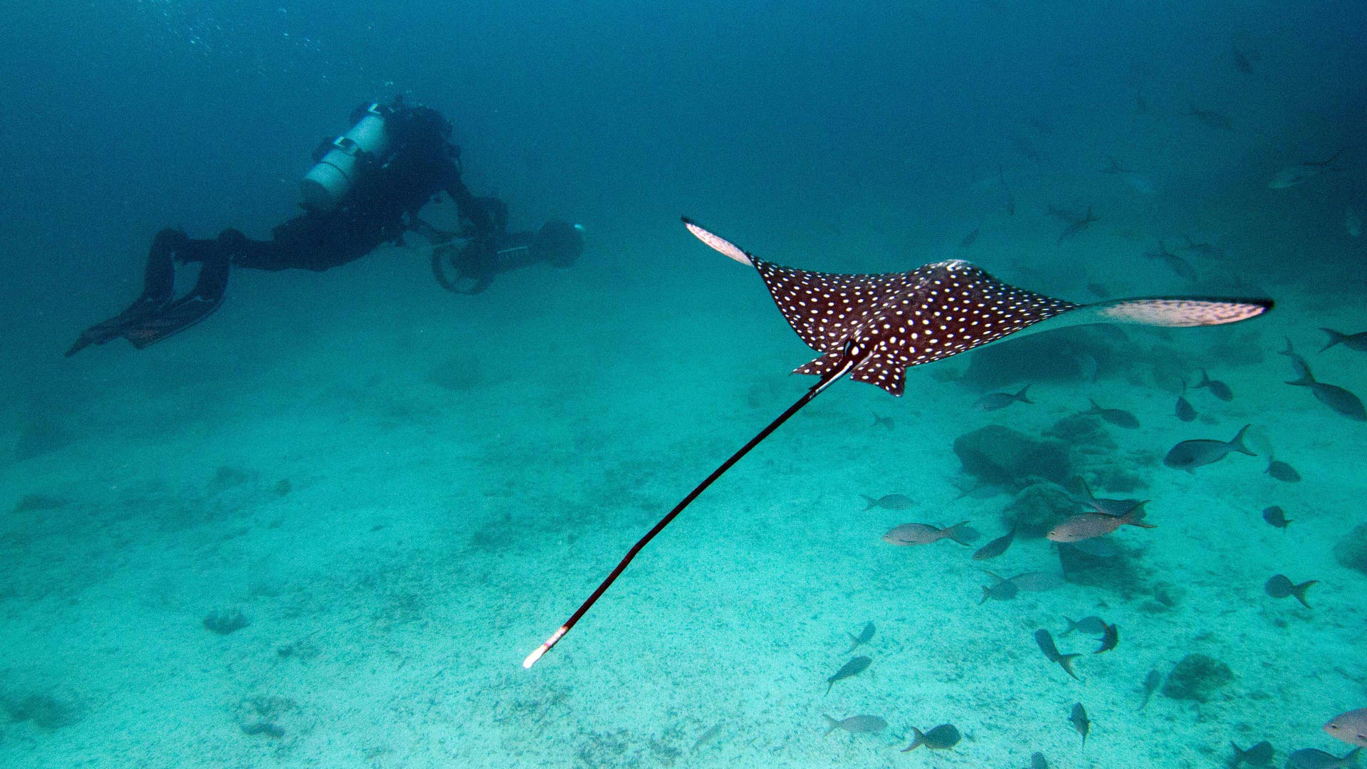
In this May 2013 photo provided by Catlin Seaview Survey, Christophe Bailhache navigates an SVII camera through a large group of sea lions during a survey dive at Champion Island in Galapagos. Few have laid eyes on many of the volcanic islands of the Galapagos archipelago that remain closed to tourists. But soon the curious will be able to explore these places that inspired Charles Darwin's theory of evolution from their computers or mobile devices. Google Maps sent crews armed with backpack-mounted Street View cameras and underwater gear to the Galapagos, and will be bringing the islands' natural wonders to the Internet. (AP Photo/Catlin Seaview Survey)read moreAP2013Share![Google_Galapagos_Stre_Grat__1_]() In this May 2013 photo provided by Catlin Seaview Survey, Christophe Bailhache with an SVII camera is escorted underwater by a Spotted Eagle Ray during a survey dive in the Galapagos Islands. Few have laid eyes on many of the volcanic islands of the Galapagos archipelago that remain closed to tourists. But soon the curious will be able to explore these places that inspired Charles Darwin's theory of evolution from their computers or mobile devices. Google Maps sent crews armed with backpack-mounted Street View cameras and underwater gear to the Galapagos, and will be bringing the islands' natural wonders to the Internet. (AP Photo/Catlin Seaview Survey)read moreAP2013Share
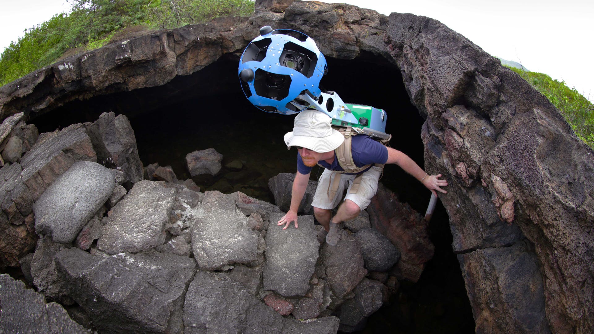
In this May 2013 photo provided by Catlin Seaview Survey, Christophe Bailhache with an SVII camera is escorted underwater by a Spotted Eagle Ray during a survey dive in the Galapagos Islands. Few have laid eyes on many of the volcanic islands of the Galapagos archipelago that remain closed to tourists. But soon the curious will be able to explore these places that inspired Charles Darwin's theory of evolution from their computers or mobile devices. Google Maps sent crews armed with backpack-mounted Street View cameras and underwater gear to the Galapagos, and will be bringing the islands' natural wonders to the Internet. (AP Photo/Catlin Seaview Survey)read moreAP2013Share![Google_Galapagos_Stre_Grat__5_]() In this May 2013 photo provided by Google, Daniel Orellana of the Charles Darwin Foundation climbs out of an Isabela island where he was collecting imagery on the Galapagos. The lava landscapes found on the island help tell the story of the formation of the Galapagos. Few have laid eyes on many of the volcanic islands of the Galapagos archipelago that remain closed to tourists. But soon the curious will be able to explore these places that inspired Charles Darwin's theory of evolution from their computers or mobile devices. Google Maps sent crews armed with backpack-mounted Street View cameras and underwater gear to the Galapagos, and will be bringing the islands' natural wonders to the Internet. (AP Photo/Google)read moreAP2013Share
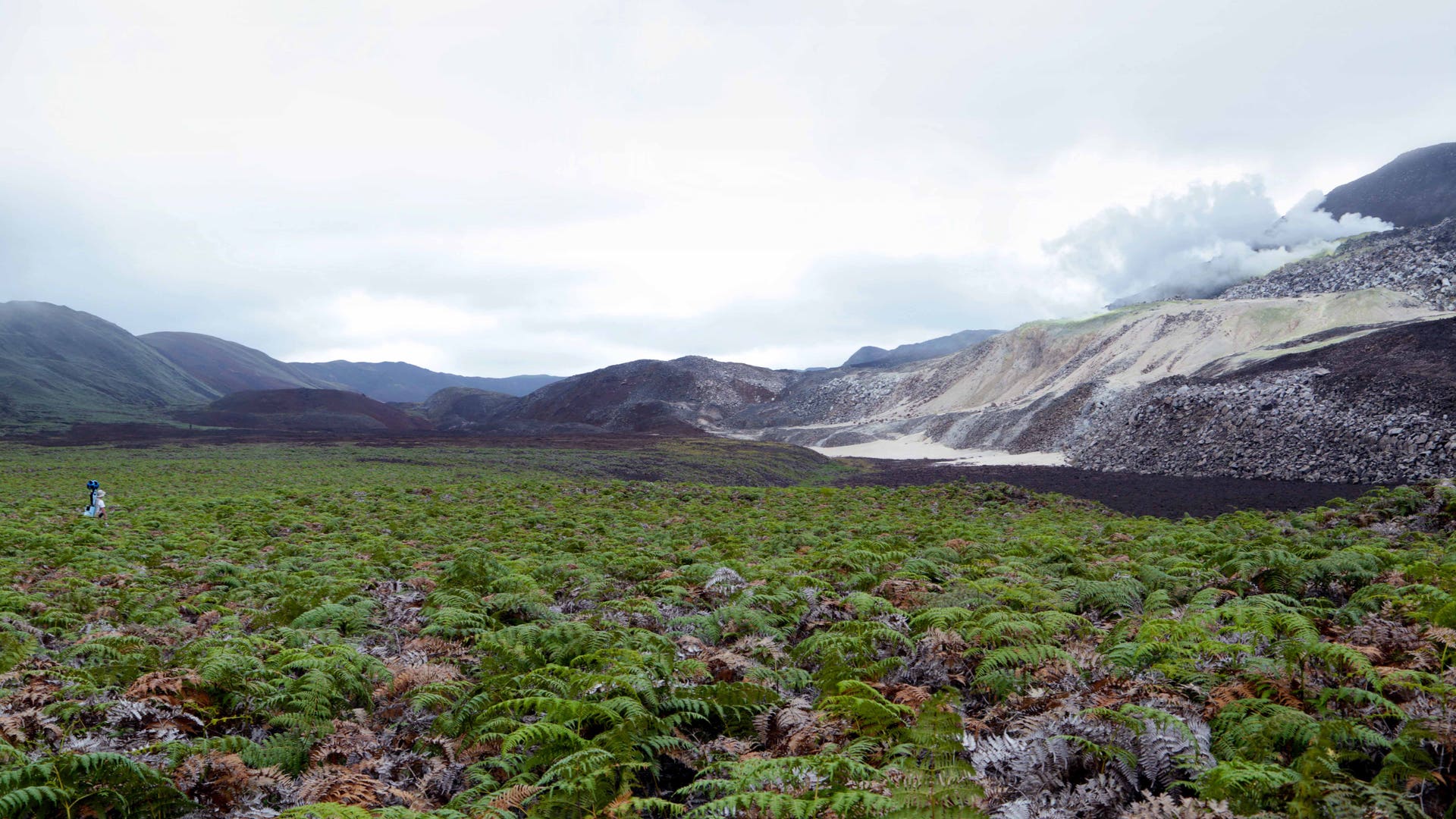
In this May 2013 photo provided by Google, Daniel Orellana of the Charles Darwin Foundation climbs out of an Isabela island where he was collecting imagery on the Galapagos. The lava landscapes found on the island help tell the story of the formation of the Galapagos. Few have laid eyes on many of the volcanic islands of the Galapagos archipelago that remain closed to tourists. But soon the curious will be able to explore these places that inspired Charles Darwin's theory of evolution from their computers or mobile devices. Google Maps sent crews armed with backpack-mounted Street View cameras and underwater gear to the Galapagos, and will be bringing the islands' natural wonders to the Internet. (AP Photo/Google)read moreAP2013Share![Google_Galapagos_Stre_Grat__4_]() In this May 2013 photo provided by Google, Daniel Orellana of the Charles Darwin Foundation is shown crossing a field of ferns to reach some naturallyoccurring sulfur mines on the top of Sierra Negra, an active volcano on Isabela Island in the Galapagos. The Google Maps team traveled for over hours, hiking and on horseback, to reach this remote location. Few have laid eyes on many of the volcanic islands of the Galapagos archipelago that remain closed to tourists. But soon the curious will be able to explore these places that inspired Charles Darwin's theory of evolution from their computers or mobile devices. Google Maps sent crews armed with backpack-mounted Street View cameras and underwater gear to the Galapagos, and will be bringing the islands' natural wonders to the Internet. (AP Photo/Google)read moreAP2013Share
In this May 2013 photo provided by Google, Daniel Orellana of the Charles Darwin Foundation is shown crossing a field of ferns to reach some naturallyoccurring sulfur mines on the top of Sierra Negra, an active volcano on Isabela Island in the Galapagos. The Google Maps team traveled for over hours, hiking and on horseback, to reach this remote location. Few have laid eyes on many of the volcanic islands of the Galapagos archipelago that remain closed to tourists. But soon the curious will be able to explore these places that inspired Charles Darwin's theory of evolution from their computers or mobile devices. Google Maps sent crews armed with backpack-mounted Street View cameras and underwater gear to the Galapagos, and will be bringing the islands' natural wonders to the Internet. (AP Photo/Google)read moreAP2013Share![Google_Galapagos_Stre_Grat__3_]() In this May 2013 photo provided by Google, a giant tortoise crawls along the path near Googler Karin TuxenBettman while she collects imagery with the Street View Trekker in Galapaguera, a tortoise breeding center, which is managed by the Galapagos National Park Service, in Ecuador. Few have laid eyes on many of the volcanic islands of the Galapagos archipelago that remain closed to tourists. But soon the curious will be able to explore these places that inspired Charles Darwin's theory of evolution from their computers or mobile devices. Google Maps sent crews armed with backpack-mounted Street View cameras and underwater gear to the Galapagos, and will be bringing the islands' natural wonders to the Internet. (AP Photo/Google)read moreAP2013Share
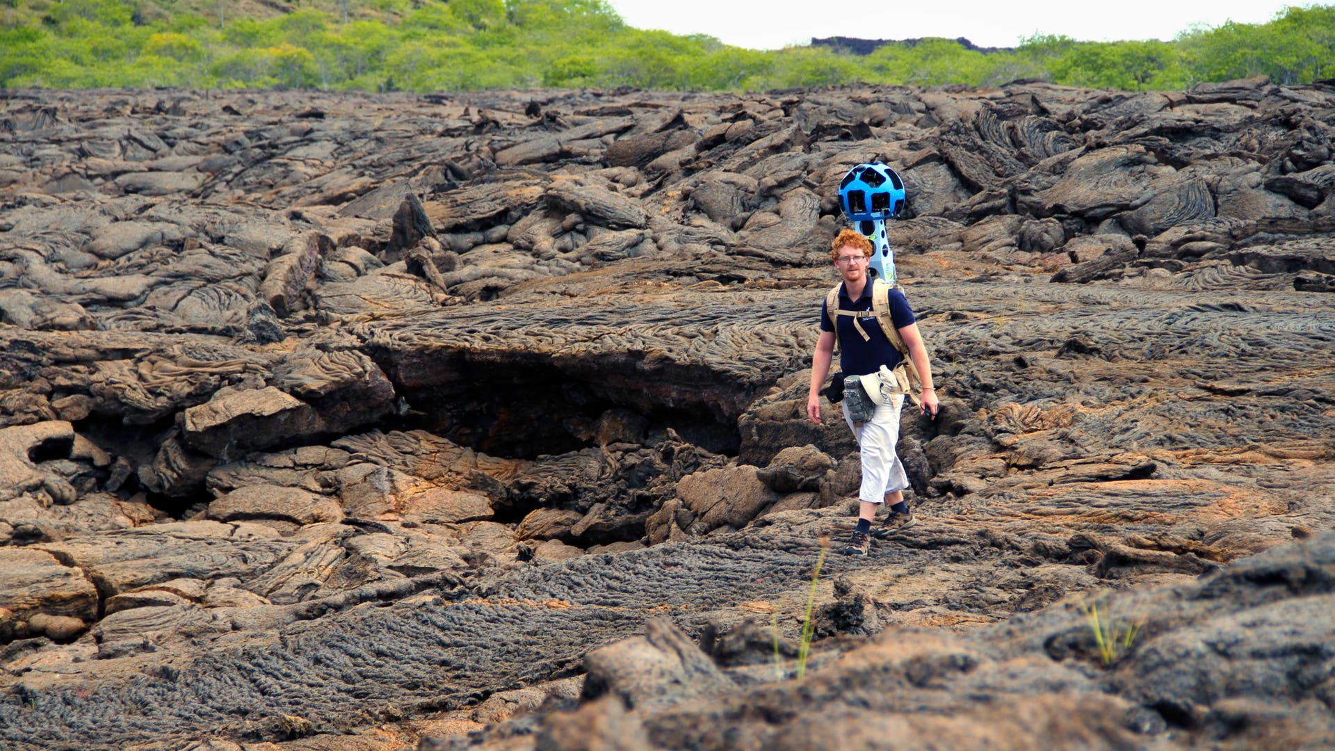
In this May 2013 photo provided by Google, a giant tortoise crawls along the path near Googler Karin TuxenBettman while she collects imagery with the Street View Trekker in Galapaguera, a tortoise breeding center, which is managed by the Galapagos National Park Service, in Ecuador. Few have laid eyes on many of the volcanic islands of the Galapagos archipelago that remain closed to tourists. But soon the curious will be able to explore these places that inspired Charles Darwin's theory of evolution from their computers or mobile devices. Google Maps sent crews armed with backpack-mounted Street View cameras and underwater gear to the Galapagos, and will be bringing the islands' natural wonders to the Internet. (AP Photo/Google)read moreAP2013Share![Google_Galapagos_Stre_Grat__2_]() In this May 2013 photo provided by Google, Daniel Orellana of the Charles Darwin Foundation crosses a rocky lava field to reach a land iguana restoration area in Bahia Cartago, Isabela Island in the Galapagos. Bahia Cartago is a protected area not accessible to tourists but the Street View Trekker was invited to collect imagery there. Few have laid eyes on many of the volcanic islands of the Galapagos archipelago that remain closed to tourists. But soon the curious will be able to explore these places that inspired Charles Darwin's theory of evolution from their computers or mobile devices. Google Maps sent crews armed with backpack-mounted Street View cameras and underwater gear to the Galapagos, and will be bringing the islands' natural wonders to the Internet. (AP Photo/Google)read moreAP2013Share
In this May 2013 photo provided by Google, Daniel Orellana of the Charles Darwin Foundation crosses a rocky lava field to reach a land iguana restoration area in Bahia Cartago, Isabela Island in the Galapagos. Bahia Cartago is a protected area not accessible to tourists but the Street View Trekker was invited to collect imagery there. Few have laid eyes on many of the volcanic islands of the Galapagos archipelago that remain closed to tourists. But soon the curious will be able to explore these places that inspired Charles Darwin's theory of evolution from their computers or mobile devices. Google Maps sent crews armed with backpack-mounted Street View cameras and underwater gear to the Galapagos, and will be bringing the islands' natural wonders to the Internet. (AP Photo/Google)read moreAP2013Share- Published7 Images
Google Maps Galapagos Islands On Land And Sea
Users of the web giant’s Google Street View program will be able to take a panoramic tour of the island – both above and below the waterline.
Move Forward
- Google Maps Galapagos Islands On Land And Sea


Thumbnail View
Image 0 of 7
