National forecast for Monday, September 8
Fox News senior meteorologist Janice Dean has your FoxCast.
A tropical storm is menacing the Cabo Verde Islands on Tuesday after becoming the latest system to break records during a busy 2020 Atlantic hurricane season.
The U.S. National Hurricane Center (NHC) in Miami said Tropical Storm Rene is bringing tropical-storm-force winds and heavy rains to the western islands.
Rene, which formed Monday as the Atlantic’s earliest known 17th named "R"-storm, broke the previous record of Rita, which formed Sept. 18, 2005.
As of 11 a.m. ET, the storm is located about 100 miles west-northwest of the Cabo Verde Islands, with maximum sustained winds of 40 mph as it moves west at 16 mph.
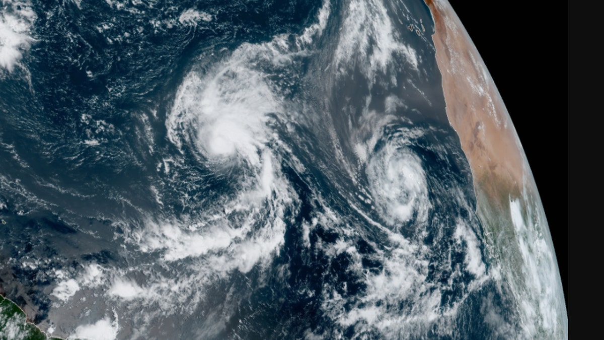
Tropical Storms Rene and Paulette can be seen over the Atlantic Ocean on Tuesday, Sept. 8, 2020. (NOAA/GOES-East)
A tropical storm warning remains in effect for the Cabo Verde Islands, where gusty winds and rainfall will continue through Tuesday before the storm curves away from the west-northwest.
"Little change in strength is expected today, followed by gradual strengthening on Thursday and Friday," the NHC said. "Rene is forecast to become a hurricane in a couple of days."
Forecast models show the storm staying at sea for the foreseeable future.
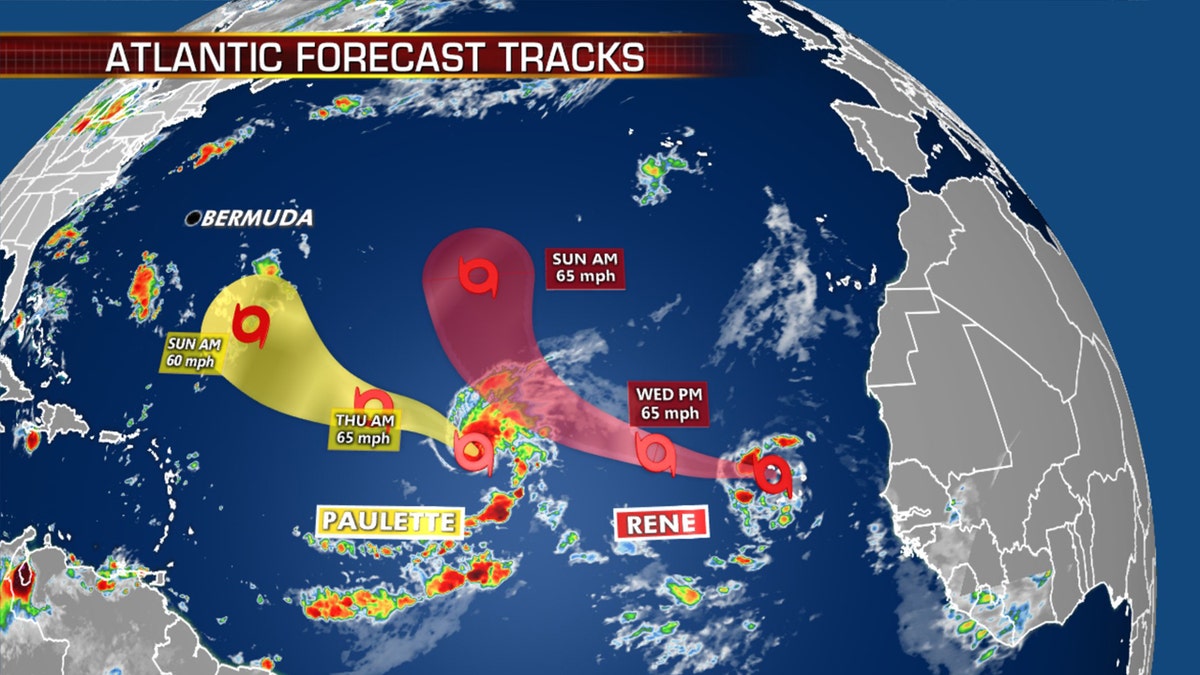
The forecast track of Tropical Storms Paulette and Rene. (Fox News)
Rene was one of two storms that formed Monday; Tropical Storm Paulette took shape earlier in the day in the central Atlantic, far from land.
HURRICANE CENTER MONITORING 4 AREAS FOR DEVELOPMENT, INCLUDING 2 WITH 'HIGH' CHANCES
Paulette now has maximum sustained winds of 65 mph, with modest strengthening expected over the next few days.
The storm was centered about 1,285 miles west of the Cabo Verde Islands and moving northwest at 6 mph, posing no current threats to land.
Forecasters from the NHC said that Paulette would possibly be near hurricane strength by Monday night before gradual weakening starts to take place.
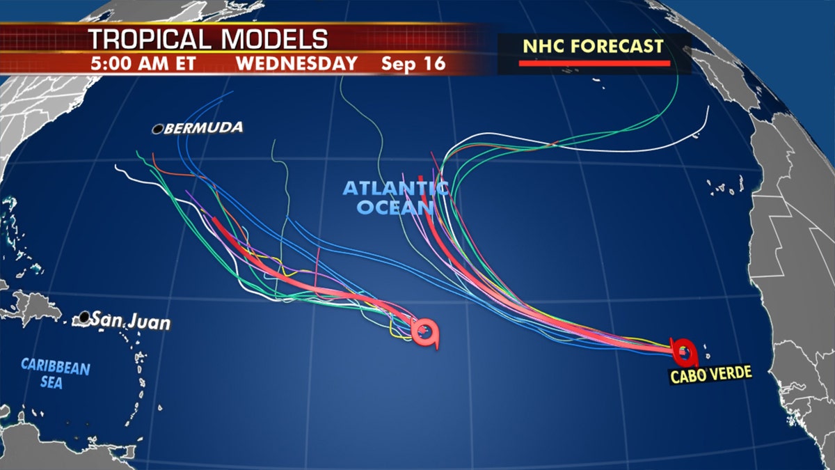
Tropical models show that Paulette will draw closer to Bermuda by next week. (Fox News)
Bermuda may need to monitor Paulette next week, but for now, the storm isn’t expected to strengthen significantly this week.
Another disturbance southwest of Bermuda has a slight chance of gaining some tropical organization later this week as it approaches the Carolinas, but isn’t a major concern at this time.
Historically, September produces the most Atlantic Ocean basin tropical activity. The two current tropical storms are the earliest 16th and 17th named storms, continuing a trend during the 2020 Atlantic hurricane season.
CLICK HERE FOR MORE WEATHER COVERAGE FROM FOX NEWS
Tropical activity historically climbs through Sept. 10, when it peaks and starts to slowly go back down.
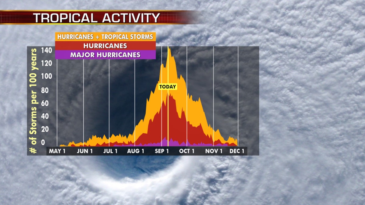
Hurricane season peaks on Sept. 10, and then starts to decrease. (Fox News)
The two previous storms, Nana and Omar, were the earliest 14th and 15th named storms on record.
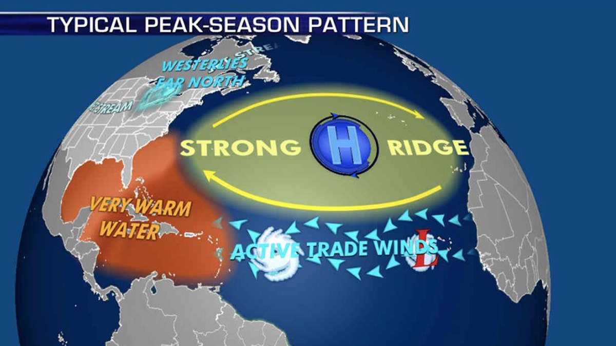
The patterns during the peak of hurricane season that influence where storms travel. (Fox News)
NOAA forecasters are now calling for up to 25 named storms with winds of 39 mph or higher; of those, seven to 10 could become hurricanes. Among those hurricanes, three to six will be major, classified as Category 3, 4, and 5 with winds of 111 mph or higher.
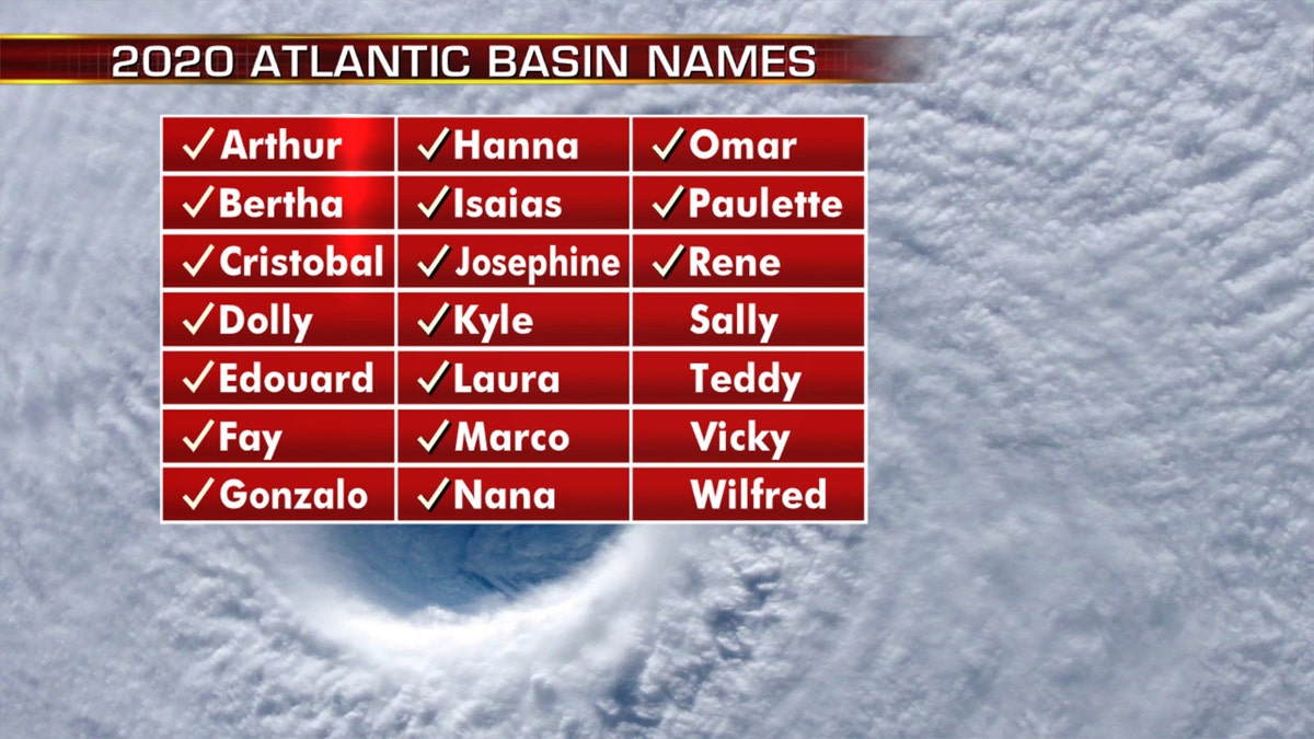
The names of the 2020 Atlantic hurricane season. (Fox News)
That's far above an average year. Based on 1981-to-2010 data, that is 12 named storms, six hurricanes and three major hurricanes. So far this year, there have been 17 named storms, including five hurricanes.
CLICK HERE FOR THE FOX NEWS APP
The 2020 Atlantic hurricane season runs from June 1 to Nov. 30 and includes the names Arthur, Bertha, Cristobal, Dolly, Edouard, Fay, Gonzalo, Hanna, Isaias, Josephine, Kyle, Laura, Marco, Nana, Omar, Paulette, Rene, Sally, Teddy, Vicky and Wilfred.
Fox News' Adam Klotz and Brandon Noriega contributed to this report.


