The latest tropical storm during a record-breaking 2020 Atlantic hurricane season formed Sunday morning and may present a threat to the U.S. Gulf Coast later this week.
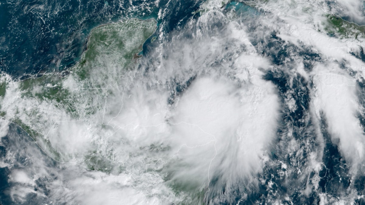
The National Hurricane Center (NHC) in Miami said that Tropical Storm Zeta formed near Cuba, becoming the earliest named 27th Atlantic storm recorded.
"While you were sleeping, Tropical Storm #Zeta developed over the western Caribbean, becoming the 27th named storm of the 2020 Atlantic Hurricane season," the National Weather Service (NWS) tweeted.
The formation of Zeta means so far this year's Atlantic hurricane season is close to tying the all-time record of 28 set back in 2005.
HURRICANE EPSILON'S EYE REVEALS 'STADIUM EFFECT' AS POWERFUL STORM TO SIDESWIPE BERMUDA
As of 2 p.m. EDT, the NHC said that Zeta is located about 275 miles south-southeast of the western tip of Cuba and 255 miles southeast of Cozumel, Mexico.
The storm has maximum sustained winds of 40 mph and is stationary over the western Caribbean.

Tropical Storm Zeta formed Sunday near Cuba, becoming the earliest named 27th Atlantic storm recorded. (NOAA/GOES-East)
"Tropical Storm Zeta now spinning off the coast of Mexico," Fox News meteorologist Adam Klotz said on "Fox & Friends Weekend." "We're still going to see possibly another hurricane as we're still moving through hurricane season, even though we're getting closer and closer to winter-like temperatures across the middle of the country."
According to the NHC, the storm is forecast to make a northwestern turn by late Sunday and increase in forward speed.
The storm is forecast to move near or over the northern Yucatan Peninsula of Mexico late Monday before reaching the Gulf of Mexico. A hurricane watch has been issued for areas of the Yucatan.
"This is going to run up into the Gulf of Mexico, the water still warm, climbing up to a Category 1 hurricane," Klotz said Sunday.
HURRICANE EPSILON APPROACHES BERMUDA AFTER STORM 'RAPIDLY INTENSIFIED'
Gradual strengthening is expected, and Zeta is forecast to become a hurricane by late Monday or early Tuesday. The storm is also expected to pick up speed, with impacts possibly reaching the central Gulf Coast by midweek.
"By Wednesday, heavy rainfall associated with Zeta will begin to affect the central Gulf Coast region, which may lead to flash flooding in urban areas," the NHC said.
Current forecast models show that Zeta is forecast to approach the northern Gulf Coast as a tropical storm Tuesday night and Wednesday. The storm could bring storm surge, rainfall, and wind impacts from Louisiana to the Florida Panhandle.
"You're seeing a lot of these (models) running up to an area that's just been battered, Louisiana stretching up to the Florida Panhandle," Klotz said.
Residents in these areas are advised to monitor the forecast on the progress of Zeta.
Zeta represents a record for the earliest 27th named storm, beating out Nov. 29 in 2005, according to Colorado State University hurricane researcher Phil Klotzbach.
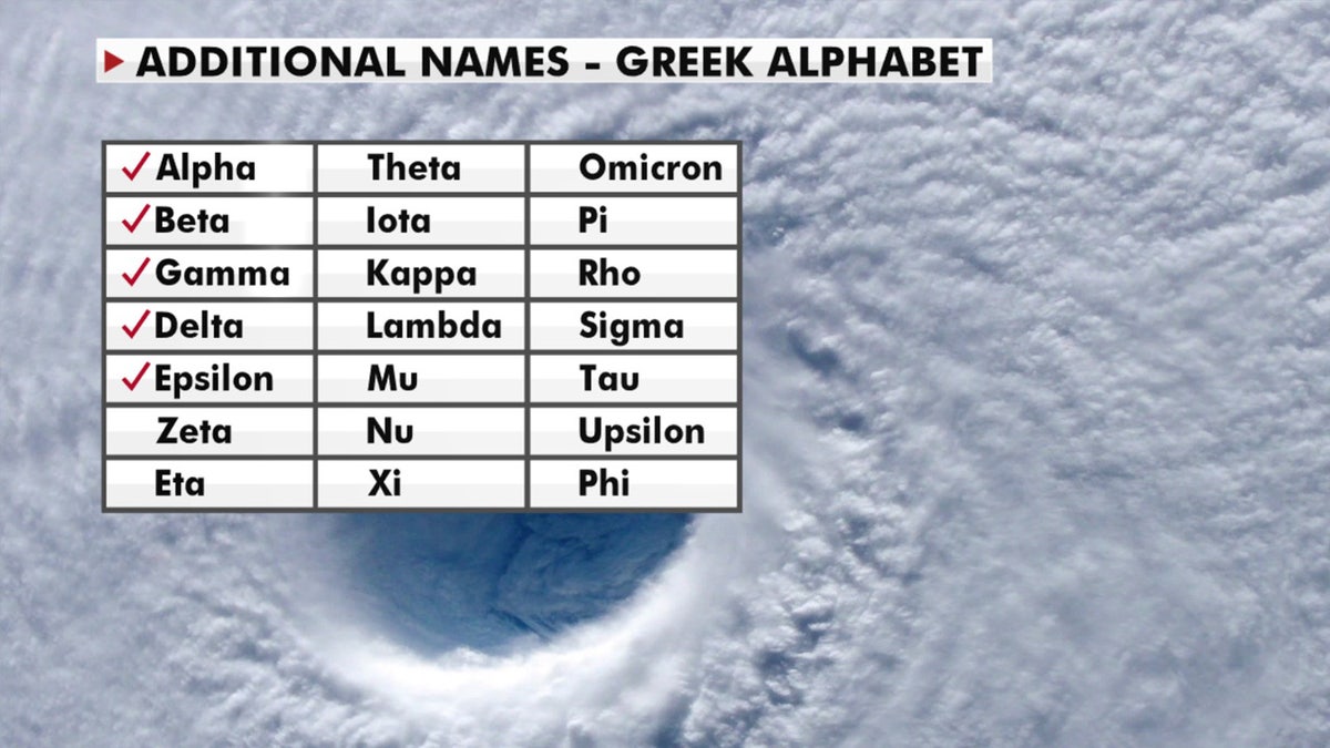
There is just over one month left in the 2020 Atlantic hurricane season, which ends Nov. 30, but this season has broken numerous records as forecasters in September ran out of traditional names and went to the Greek alphabet for storms Alpha and Beta.
CLICK HERE FOR MORE WEATHER COVERAGE FROM FOX NEWS
NOAA forecasters had called for up to 25 named storms this season with winds of 39 mph or higher; of those, seven to 10 could become hurricanes. Among those hurricanes, three to six will be major, classified as Category 3, 4 and 5 with winds of 111 mph or higher.
That's far above an average year. Based on 1981-to-2010 data, that is 12 named storms, six hurricanes, and three major hurricanes. So far this year, there have been 27 named storms, including 10 hurricanes and, of those, four major hurricanes.

A look at the Greek alphabet names that are being used for the 2020 Atlantic hurricane season, after the hurricane center ran out of official names due to the number of storms. (Fox News)
The last time the Greek alphabet was used in the Atlantic was in 2005, the year of Hurricane Katrina. With a total of 28 storms that year, the first six letters of the Greek alphabet were used: Alpha, Beta, Gamma, Delta, Epsilon and Zeta.
CLICK HERE FOR THE FOX NEWS APP
Fox News' Adam Klotz, Janice Dean, Brandon Noriega, and the Associated Press contributed to this report.


