National forecast for Wednesday, April 22
Fox News senior meteorologist Janice Dean has your FoxCast.
Get all the latest news on coronavirus and more delivered daily to your inbox. Sign up here.
A new storm system emerging from the West is setting the stage for more severe weather Wednesday from the Southern Plains to the Southeast, a region that's seen hundreds of tornadoes this month.
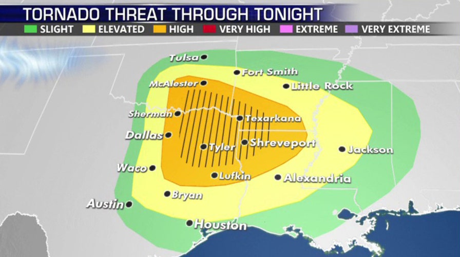
Severe weather will develop Wednesday into the night in eastern Oklahoma and Texas into Arkansas, Louisiana, and Mississippi.
"We have the potential for severe weather," Fox News Senior Meteorologist Janice Dean said on "Fox & Friends." "Another severe weather outbreak over parts of the same areas that have seen tornadoes over the last several weeks."
SEVERE THUNDERSTORM DANGERS: WHY YOU SHOULD TAKE WARNINGS SERIOUSLY
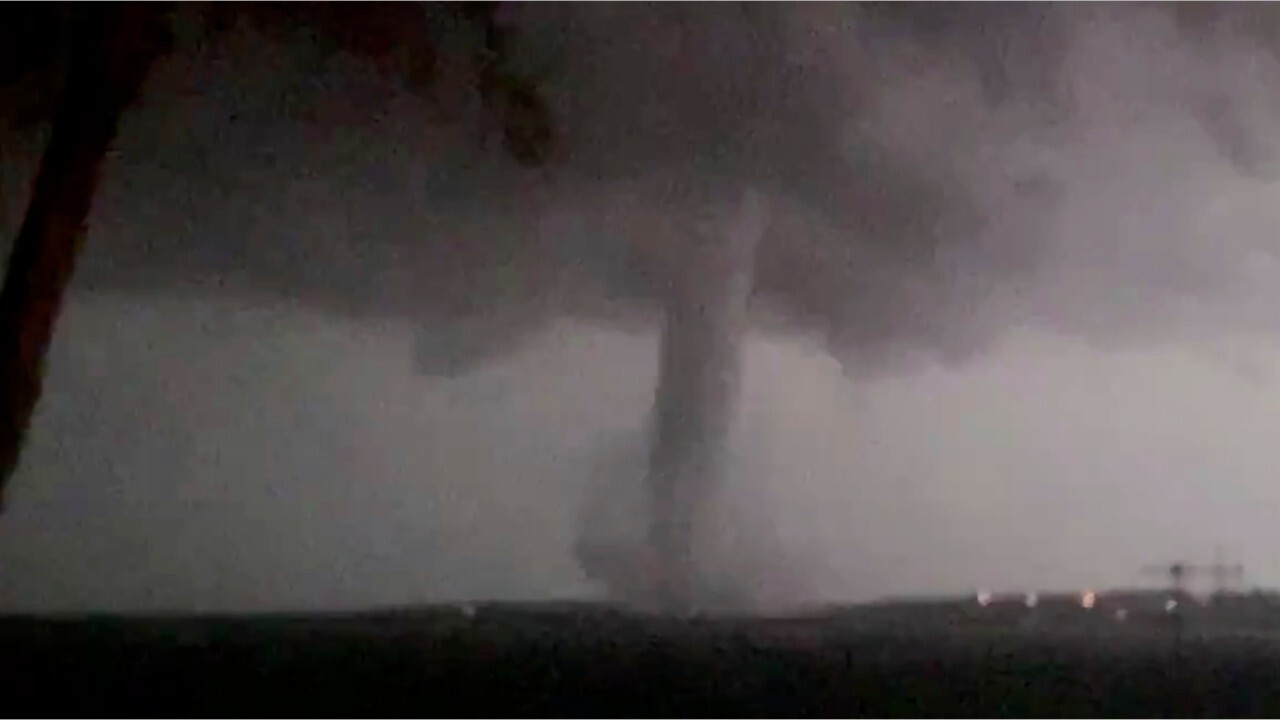
The primary threat from the storms is large hail, damaging winds, flash flooding, and potentially large tornadoes.

The greatest threat for severe weather and tornadoes on Wednesday across the Southern Plains and South. (Fox News)
According to the National Weather Service's (NWS) Storm Prediction Center (SPC), storms will develop east of the Interstate 35 corridor before heading into the Deep South.
Forecasters said that thunderstorms are expected by late Wednesday morning, with the possibility of hailstones greater than 2 inches.

Storms are forecast to develop east of the Interstate 35 corridor and move east throughout the day on Wednesday. (Fox News)
Southeastern Oklahoma and northeastern Texas will be at higher risk for large tornadoes as the day goes on.
WHERE DO TORNADOES HIT THE MOST IN THE US? HERE ARE THE TOP 5 STATES
The SPC also warns that the storms will have a wind-damage threat, increasing as the storms move east, possibly stretching all the way to the Mississippi River area.
"Although the severe threat should become more isolated during the overnight period, a wind-damage and tornado threat could continue as far east as the central Gulf Coast states," the SPC said.
According to the SPC, more than 25 million Americans are under the threat of severe weather Wednesday, in cities including Dallas and Fort Worth, Houston, Oklahoma City, Tulsa, and into Baton Rouge, La.
The storm system is also bringing more rain to areas that have seen above-normal precipitation in recent days.
CLICK HERE FOR MORE WEATHER COVERAGE FROM FOX NEWS
"The heavy rains from this next system will likely move over areas that recently received heavy rains and flooding," the NWS Weather Prediction Center said. "Stream flows are much above average across these areas, with the expected additional rains likely to produce additional flooding across portions of Louisiana, Mississippi and Alabama."

The threat of flooding and flash flooding increases this week as another storm brings the threat of more rain for an already saturated region. (Fox News)
On Thursday, the severe weather threat shifts to the Southeast and North Florida.

The threat for severe weather shifts east by Thursday. (Fox News)
"Large hail, damaging winds, and tornadoes will be a possibility not only today but also tomorrow and into Friday," Dean said on "Fox & Friends."
CLICK HERE FOR THE FOX NEWS APP
Unseasonable chill for Midwest, Mid-Atlantic, and Northeast

The forecast for the U.S. on April 22, 2020. (Fox News)
A cold front is bringing an unexpected chill for the rest of the nation Wednesday.
Below-average temperatures stretch from the eastern Ohio River Valley, Mid-Atlantic, and Northeast.

Freeze warnings and frost advisories have been issued due to cold air associated with a cold front in the Midwest and Northeast. (Fox News)
Freeze warnings and frost advisories are in effect overnight into Wednesday morning due to the chillier air.


