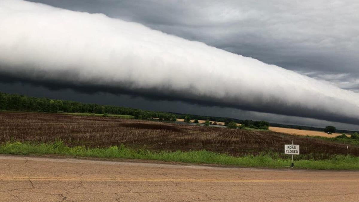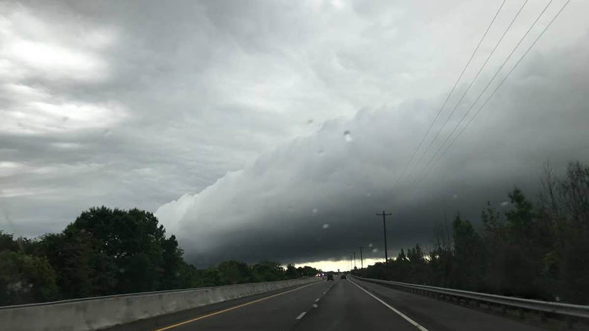
Colby Hutton, of Adamsville, Tennessee, snapped a picture of a roll cloud after a thunderstorm struck. (Colby Hutton)
A funnel-like cloud filled the sky in Tennessee as a thunderstorm in the area came to a halt. Residents were stunned by the mysterious cloud formation, which some compared to a UFO.
Angie Hutton told Fox News on Tuesday that her son, Colby, of Adamsville, snapped a photo of the cloud while traveling over the Harrison-McGarity Bridge in Savannah several weeks ago.
Hutton sent the picture to WMC-TV in Memphis, hoping meteorologists at the news station would be able to identify the rare sight. Last week, WMC-TV confirmed the eerie scene was not a UFO after all — it's actually a roll cloud.

Colby Hutton (Colby Hutton shares another view of the roll cloud he discovered while traveling over a Tennessee bridge.)
A roll cloud is a "tube-shaped" cloud that occasionally pops up after a thunderstorm.
'SUPERSONIC TIC TAC' UFO STALKED US AIRCRAFT CARRIER FOR DAYS, PENTAGON REPORT REVEALS
"Roll clouds are relatively rare; they are completely detached from the thunderstorm base or other cloud features, thus differentiating them from the more familiar shelf clouds," the National Weather Service (NWS) explains in a post online. "Roll clouds usually appear to be 'rolling' about a horizontal axis, but should not be confused with funnel clouds."
NWS Memphis said it resembled a "rolling pin moving through the sky" in a Facebook post earlier this month, which has been shared by hundreds of people. Dozens of people commented on the jaw-dropping photo — some even sharing stunning views of their own.
MYSTERIOUS MARS ROCK FORMATION EXPLAINED - AND IT DOESN'T INVOLVE UFOS
"I love cloud formations!" one Facebook user wrote.
"Beautiful and scary," another commented.
"That cloud was [in] my view as I drove to Selmer that day. It was wild looking!" a woman added.


