Swimmers pose for a selfie as waves hit the shore at Sydney's Bondi Beach during a heatwave that hit Australia's largest city, November 20, 2015. (REUTERS/Jason Reed)
Another month, another temperature record.
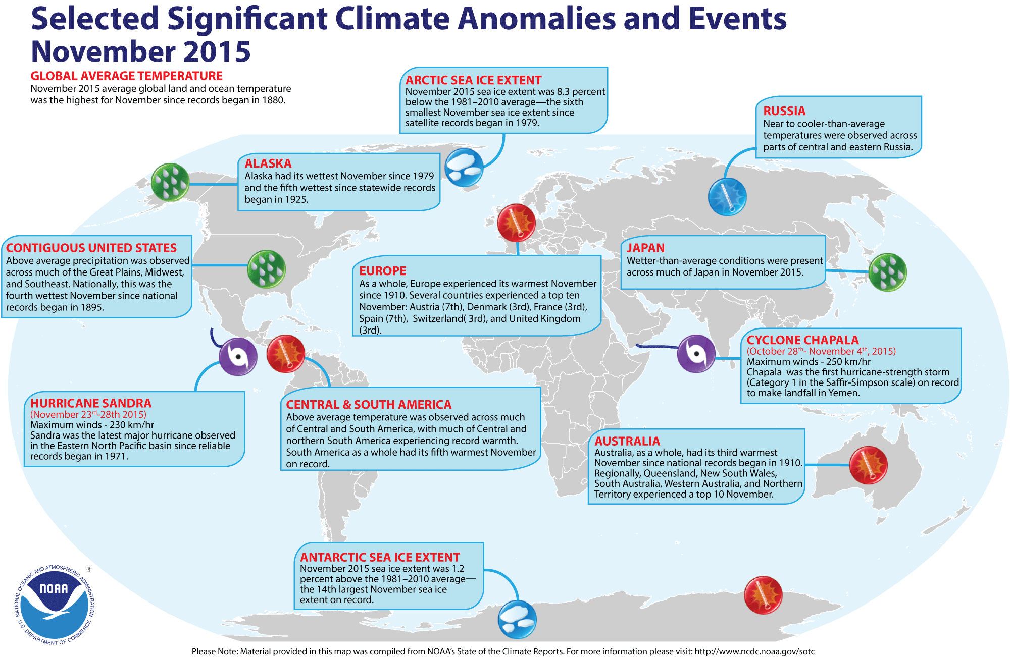
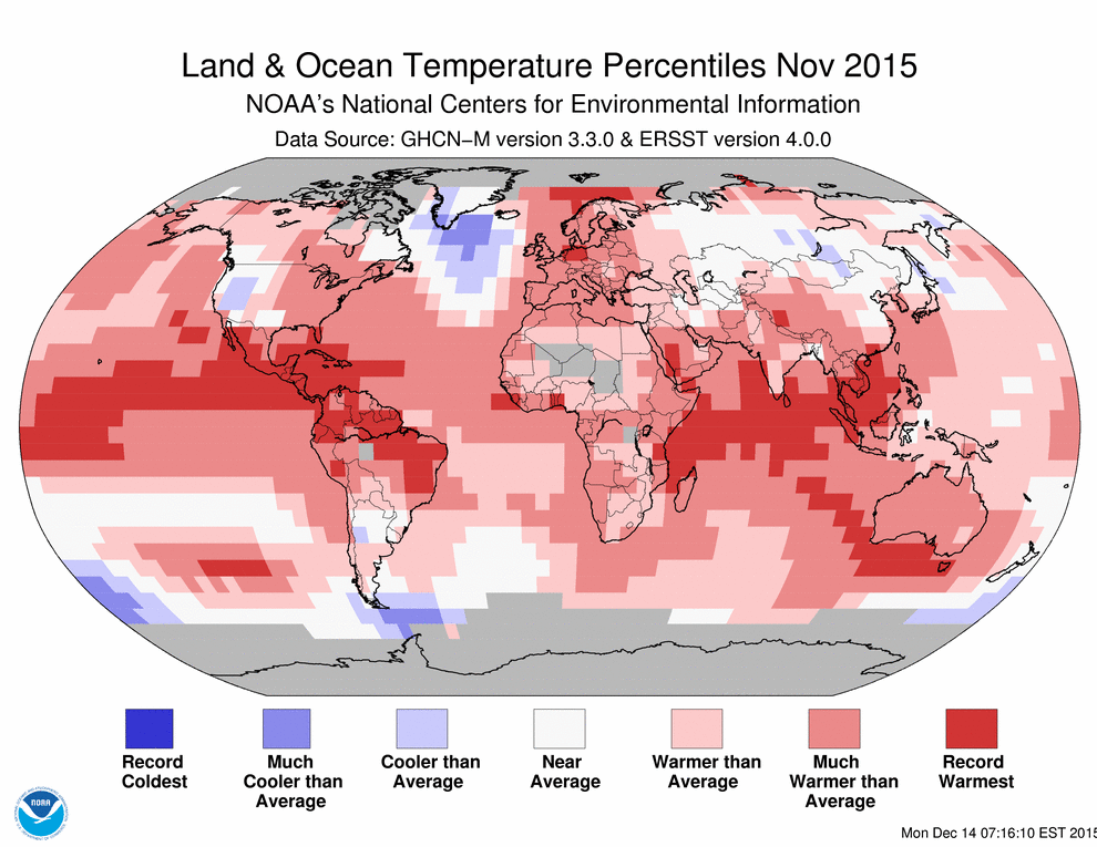
That was the case in November, which saw the highest temperatures globally since record keeping began in 1880. It also marked a trend that should see 2015 follow 2014 in becoming the hottest on record, given that the first 11 months of the year were also record warm.
The National Oceanic and Atmospheric Administration announced Thursday that November temperature across global land and ocean surfaces was 1.75 degrees Fahrenheit above the 20th century average. This was the highest for November in the 1880-2015 record, surpassing the previous record set in 2013 by 0.27 degrees, and marking the seventh consecutive month that a monthly global temperature record was broken.
Related: Searing 164-degree temps in Iran as 'heat dome' traps Middle East
The year-to-date temperature across global land and ocean surfaces was 1.57 degrees above the 20th century average. This was the highest for January-November in the 1880-2015 record, surpassing the previous record set last year by 0.25 degrees. A similar trend was seen from September-November temperature across global land and ocean surfaces, which was 1.73 degrees above the 20th century average. This was the highest for September-November in the 1880-2015 record, surpassing the previous record set last year by 0.38 degrees.

(NOAA)
The December global temperature would have to be at least 1.46 degrees below average--or 0.43 degrees colder than the current record low December temperature of 1916 for 2015 to not become the warmest year in the 136-year period of record.
If 2015 does turn out to be the warmest, it wouldn’t be all that surprising. With many scientists citing the impact of global warming, 2014 proved to be the warmest since 1880. The 10 warmest years, with the exception of 1998, have occurred since 2000.
Related: October was hottest ever by long shot
At the same time, November Arctic sea ice was 360,000 square miles or 8.3 percent below the 1981-2010 average. This was the sixth smallest November extent since records began in 1979, according to analysis by the National Snow and Ice Data Center using data from NOAA and NASA.

(NOAA)
In contrast, Antarctic sea ice extent during November 2015 was 80,000 square miles or 1.2 percent above the 1981-2010 average, the 14th largest in the 37-year period of record.
As for drought conditions across the United States, a separate outlook for Dec. 17 to March 31 from NOAA offers some rare good news.
Related: Worst of this El Nino expected in coming months
It found that conditions will improve across the central/southern Great Plains, Mississippi Valley, and parts of the western U.S. The drought coverage across the continental U.S. is at its lowest since December 2010 – an improvement driven by wetter than usual conditions in the Western U.S. and El Nino, which is expected to bring increased precipitation to California and ease drought conditions across the desert Southwest and Great Basin.
NOAA has predicted that this year’s El Nino could be one of the strongest on record, bring wetter-than-average conditions out West from January to March and above-average temperatures in the northern half of the contiguous U.S., Alaska and much of Hawaii.
